You don’t need lockers. Maybe not even four-wheel drive, though let’s be real, you probably do. The one thing you can’t leave home without? A way to know where the hell you are.
Used to mean paper maps or that chunky standalone GPS you dug out of the glovebox in 2009. Now it’s an app. Specifically, OnX Offroad.
Veterans already know it. If you don’t, imagine Google Maps built by people who actually own muddy trucks instead of city planners. Apple and Google want you on the fastest pavement route. OnX wants you on the right trail. It tells you what’s under your tires before you drive over them.
OnX really wanted my attention. They flew me to Moab. We drove Broncos at the Easter Jeep Safari—not because OnX loves Jeeps, but because every Ford owner since 2017 gets a free year of Elite. Four apps, actually. Hunting. Fishing. Hiking. But Offroad? That’s the big one.
Moab is pretty. Hard rock. Mesas. You can crush your axle on Hell’s Revenge or just roll along scenic canyon walls. Doesn’t matter. You need to know boundaries. Respect the land or at least stay out of trouble. More often than not the backcountry is a legal patchwork. Private. Public. Tribal.
Who owns it changes whether you can camp. Shoot. Park.
“OnX Elite also includes ownership data”
Sounded better on paper than I thought. So I strapped in.
OnX On The Trail
We used the route builder first. Handy feature. Pick a start. Pick an end. It snaps to trails. If you want to draw your own line through a rock garden? Fine. Elevation pops up. Difficulty rating follows. You see it all before the first tire rolls.
Tap a trail name. What do you get? Technical rating out of 10. Distance. Loop or point-to-point. Best season. Current conditions. Vehicle limits. Land ownership lines overlay everything. It’s not just pretty 3D terrain. It’s backed by locals. People who walk these paths.
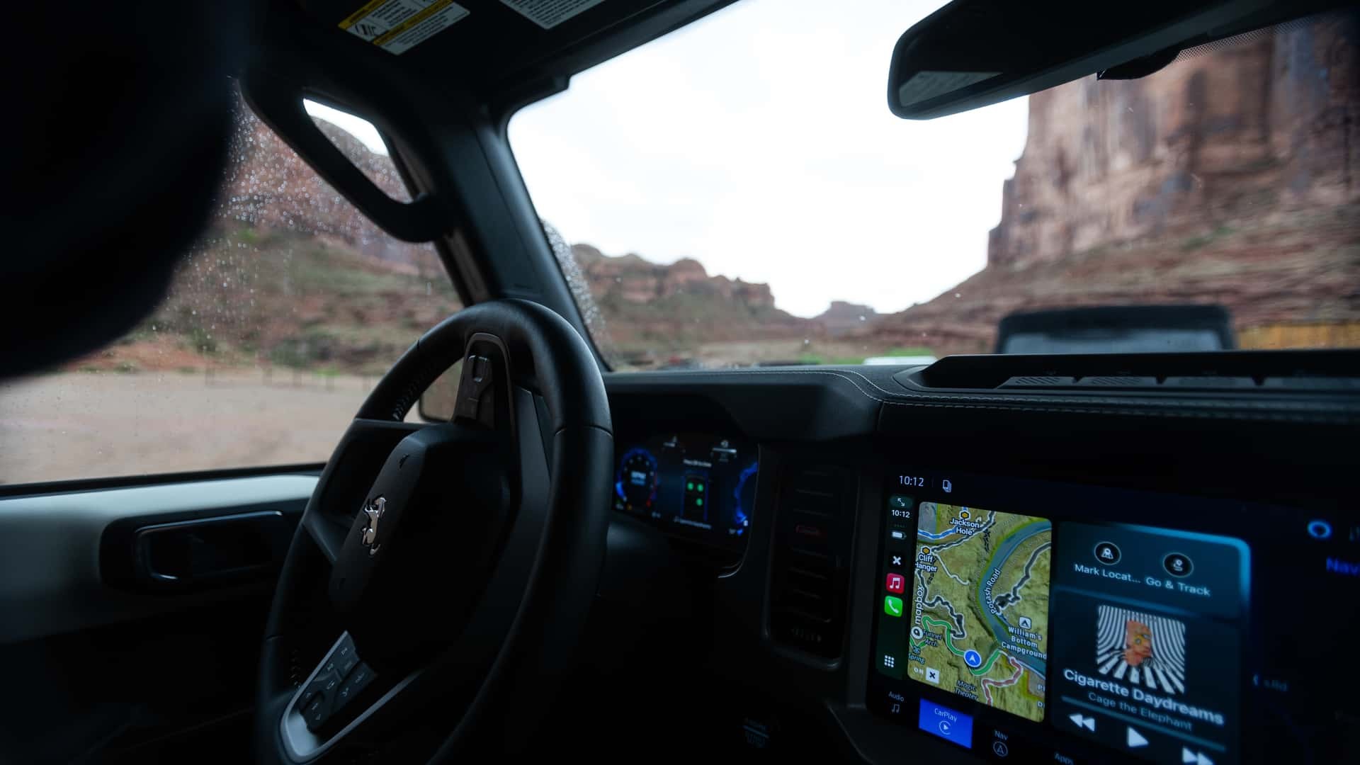
We headed west of Moab. High mesas. Beautiful views. The ride itself was boringly easy for these Broncos. No sweat. But watching that native CarPlay integration update in real-time? That was cool.
Here’s the killer feature though.
Offline maps.
Apple messes this up. Google barely gets it right. OnX lets you pick your square. An 8 by 11 mile chunk with high quality or a massive 105 by 147 mile area with less detail. You load it manually. Then you go off-grid.
We lost cell service almost immediately. Most off-road trips start with losing signal. This kept working. Fully. Topographic details. Trail data. It stayed sharp. It felt like cheating because I had the whole desert in my pocket.
I didn’t just leave the app on a shelf after Moab either. I took it to Arizona. Northern trails with Nissans. Then California desert with a Ram. The more fragmented the land ownership, the more useful this gets.
Is It Worth The Heat?
Not everything is flawless.
OnX Offroad runs heavy on the hardware. I have an iPhone 16 Pro Max. It still got hot. Hotter than Apple Maps. On a sunny dashboard it started chugging. Stuttering. Is this fair criticism? Yes. Other apps are lighter. More stable. This one pushes the CPU hard.
Does that matter when you are stuck on a ridge at 7,000 feet? Maybe. Maybe not.
For the monthly plan it’s $15. Annual is $100. That gets you the land data. The camping deep-dives.
If that sounds steep there is a cheaper tier. $35 a year. You still get maps. Waypoints. Offline caching. You just lose the ownership specifics and the heavy camping info. For a casual driver who hits a trail maybe once a season? The cheaper plan works fine.
You pay for certainty. For safety.
How much is getting stuck worth to you?